Friday 26 August 2016

In a previous post, I mentioned how enamoured we were with our recent visit to Kaslo BC, a small town of about 1,000 people. Remarkably, it's home to two National Historic Sites, one of which is the SS Moyie, the last Canadian Pacific Railway sternwheeler to travel on Kootenay Lake. Today, the Moyie is drydocked in town and is unique in that, unlike all the other sternwheelers we've seen, it is fully fitted out with mostly original fittings and furnishings. If you're not interested in antique boats, you can skip this post, but, we couldn't help but admire the beauty and craftmanship that went into this boat and will let the pictures speak for themselves. Enjoy!


 photo arrow.pngCONTINUE READING

Saturday 20 August 2016

Back on the road into the interior it was hard not to notice the electric blue of the cornflowers, the dusky, hot, sweet smell of the roadside ditches and some slight discolouration of tree leaves which hinted that both the end of summer and the end of our road trip would soon be upon us. We still had a couple of weeks planned to tour the Kootenay Rockies region, the only area of BC we hadn't explored on this, or, earlier trips. We had planned a circular route to take in most of the great destinations on offer: Revelstoke, Nelson, Sandon, Kaslo, New Denver, Creston, Cranbrook, Trail, Rossland and Grand Forks, among others. The Kootenays are a fairly small region in the southeast corner of the province, but, each town was remarkably different, not only in landscape, but, in looks, history and reason for being as well.

We started in Revelstoke, home of a national park and Mount Revelstoke with its 'Meadow in the Sky' scenic drive. We didn't mind paying park fees to drive the smooth asphalt road to the top, easily accessible to all types of vehicles. We arrived at opening time to avoid the heat of the day and crowds. A short hike to the historic firetower at the summit presented us with an absolutely spectacular display of Alpine wildflower meadows.


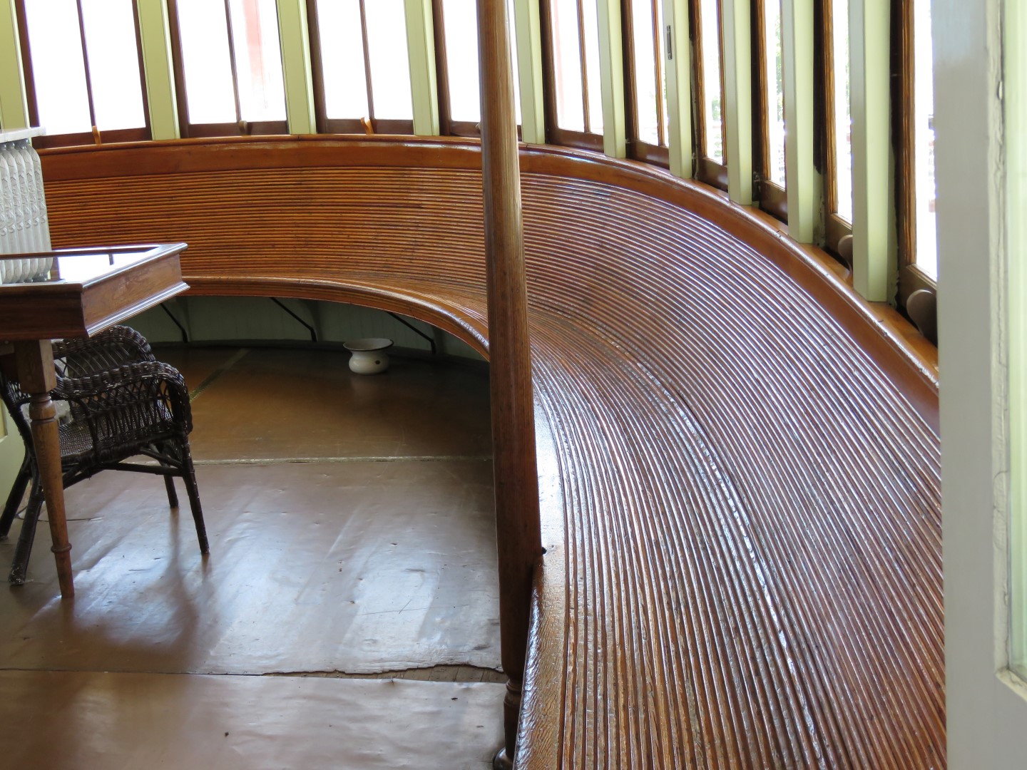
Kaslo, sometimes called the 'Switzerland of Canada', was a pleasant surprise and we were very enamoured with this town of about 1,000 people, which, for its size, punches well above its weight. We arrived just as their annual jazz festival was about to take place and the town was buzzing. A fully-occupied, historic, bustling main street with no dollar stores or thrift shops in evidence, good restaurants, two National Historic Sites (a separate post will follow later on one of these, the SS Moyie), one of the best natural harbours on Kootenay Lake, a downtown sandy beach, spectacular mountain views across Kootenay Lake and historic houses, what's not to like? Others agree, especially whoever has made a major investment in the very nice Kaslo Hotel.


We were curious about Nelson which seems to be on every list of 'top ten places to retire in Canada'. It was very nice, but, somehow didn't grab us.

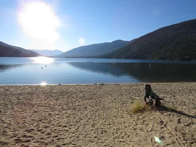
Heading out of Nelson on the BC Day (August 1) long weekend and finding all camping sites full we soon realized we needed to find somewhere to hunker down. Luckily, Kokanee Creek Provincial Park doesn't reserve all their campsites in advance and by arriving early in the morning we were able to get a site. We spent a few days here swimming and enjoying this wonderful sand beach on Kootenay Lake in the 32C heat.


We headed out after the holiday weekend and took the free ferry across Kootenay Lake at Crawford Bay. We decided to take the scenic route across a Forest Service road to Kimberly with the caveat that we'd turn around if the road was bad. Actually, it was pretty good to the summit and we were enjoying the ride. As we started down the other side it deteriorated badly until we were driving on sharp rubble with the inevitable result, pfffft.....a flat. We'd ripped a two inch gash in the tire and were about 50 km from the nearest paved road. Luckily we had everything we needed and the tire was changed in less than an hour and we were back on our way.


Creston was another place we'd never really heard of, but, it made a big impression. It's located in an incredibly fertile valley and is foodie heaven. The many fruit stands were overflowing with fresh fruit and vegetables. The valley is home to many artisans and specialty farms, which sell direct to the public and at the weekly Saturday Farmer's market including: Quack Me Up duck farm and hatchery, Purple House farm for heirloom tomatoes, Kootenay Meadows Farm for alpine cheese, fresh glass-bottled milk and organic beef, the Pickle Patch for 30+ varieties of pickles and many, many more! It's also home to Sutcliffe Farms, Western Canada's largest asparagus farm, producing about 150,000 pounds annually. I'll never resent the high price of asparagus again when I saw how it's harvested. Think of a  tractor towing about five sleds with a person laying face-down on each sled snapping off spears at ground level. They have an asparagus picker training video on YouTube: https://www.youtube.com/watch?v=QmqegHRO-3o where you can see the fascinating process in detail. They also have some very delicious sounding asparagus recipes at http://sutcliffefarms.com/recipes.html. Also, from their website, did you know asparagus grows depending on ground temperature, and can grow as much as 1 inch an hour. In ideal temperatures the fields may need to be picked twice a day. Creston was also home to an excellent family-run Polish restaurant. The day was overcast with a few showers when we visited, very appropriate weather for a hot bowl of borscht and a feast of pierogies, cabbage rolls and goulash wrapped in a large, crispy-brown potato pancake.

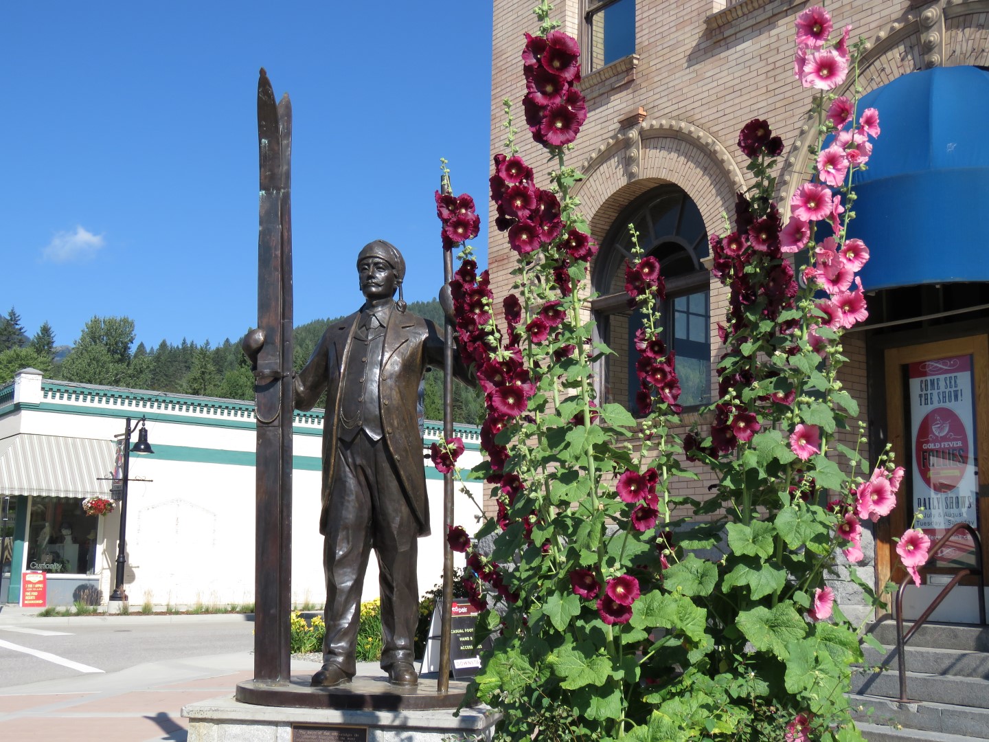
Rossland was also a delightful surprise. Another gold rush town, it has many historic buildings and about 3,500 residents. The main street was full of thriving businesses and positively gleamed as the road and sidewalks had been just rebuilt. Many buildings had made facade improvements and demonstrated pride of ownership. Just five minutes from town is Red Mountain ski resort, the nursery where Olympic skiing gold medalists Nancy Greene and Kerrin Lee Gartner both cut their teeth. Rossland was the site of the first ski competition ever held in Canada in 1897 and there is yet another Norwegian connection. Olaus Jeldness, a celebrated Norwegian, was the organizer of the race and won it becoming Canada's first national champion. His skis are in the Rossland Museum's Western Canada Ski Hall of Fame and this statue of him is prominently displayed on the main street.


Last stop on the circuit was Osoyoos, home to Osoyoos Lake and the only true desert in Canada. We had wanted to visit the Desert Centre, but, true to form, the temperature was 38C when we went through and it was too hot to think of doing anything but getting out of town to cooler temperatures, fast!


 photo arrow.pngCONTINUE READING

Saturday 13 August 2016

After the glorious weather we've had all summer, it was a bit of an adjustment going back to coastal weather again. We lost the sunshine just before arriving in Prince Rupert and we didn't see it again until a week later when we left the Bella Coola valley to head back into the interior of BC. There was fog, rain and the temperature didn't exceed 18C. In July! We're used to maritime climates, but, this was hard to take. Out came the toque and the fleece jackets, lucky we'd brought them. It reminded us of the eighteen straight days of rain we'd experienced in West Vancouver in January, very depressing. We spent a few days exploring Prince Rupert. The town seems to be making a comeback with a busy harbour, some nice public gardens and many homes under renovation. We had a tour and made special note of their brand-new marina facility at Cow Bay. Looked like a great place to stop when cruising the Inside Passage.


At the waterfront park just down the street from the marina, there were plenty of beady eagle eyes about, surveying the harbour for tasty morsels.


We were booked on two ferries. One, a large ferry from Prince Rupert to Bella Bella where we had to stay overnight. We'd then take another, much smaller ferry (only sixteen vehicles maximum)  from Bella Bella to Bella Coola where we'd again be able to take to the roads. This trip by water does cut off a lot of driving miles, but, we had an ulterior motive. We wanted to have another look at the Inside Passage with eyes now tuned to the navigational challenges involved. As mentioned, the weather was dismal and unfortunately is probably typical for the area. There was a certain misty beauty about it all though and we enjoyed the trip very much, especially with someone else doing the driving.


The large ferry on the first day was modern and comfortable, but, it was so big that you didn't really get a sense of the marine environment. When we boarded, we wondered what the lineup was for at the Purser's office. Well, we were irked to find out that people were lining up to pay another $35, in addition to their already paid fares, for the 'privilege' of entering the locked lounge at the bow of the ship which had views out both sides of the boat. There was no other place on the ship where this view could be had, inside or out. It seemed a greedy grab by BC Ferries and we refused to pay it. We did enjoy the outdoor salmon bbq (in the wind and rain) on the stern of the ship though, but, without the forward-facing view.

The second day, on the tiny ferry, the smallest in the BC Ferries fleet named the MV Nimpkish, there were friendly crew, only six other passengers, free beverages and snacks. It was a much nicer environment. Navigation was challenging, especially through Gunboat Passage, the narrowest channel on the route and only able to be done by the smaller ferries.  We were following along on our iPad's Navionics app and I'm sure the captain was concentrating very hard to line up the approach properly to get us through this tight spot. We had to pass between the point of land on the left, leaving the red buoy to starboard and avoiding the rocks.


As on a sailboat, it's always thrilling when dolphins appear to ride your bow wave. This pod of about twenty were a new species for us, the Pacific white-sided dolphin.We spent about twenty minutes enthralled by their antics and speed. We also saw a few whales.


We passed a cairn marking the spot where Alexander Mackenzie completed the first recorded transcontinental crossing of North America north of Mexico, on July 20, 1793 beating Lewis and Clark's American expedition by 12 years.


Back on the mainland and just outside Bella Coola, more Norwegian connections were seen at Hagensborg.


The weather continued to be unsettled as we made our way out of the Bella Coola valley along the 'Freedom Road'. This 450 km highway was bulldozed across the mountains in the 1950's by residents who were tired of waiting for the government to build a road. The road is excellent, mostly flat and paved, until the very end when an 18 km 'hill' is encountered. Just like the road into Telegraph Creek, this part of the road is potholed gravel with many steep switchbacks, up to 18% grades and no guardrails. It didn't feel quite as challenging as the Telegraph Creek road though because it had more pullouts to let others pass and the vertical proximity of the rock cliffs wasn't quite as dramatic. Once on the plateau at the top, the weather became sunny and warm again within just a few miles. Summer was back!
 photo arrow.pngCONTINUE READING

Saturday 6 August 2016

We had a ferry appointment in Prince Rupert for July 22, so, sadly bid a quick farewell to Yukon and started to make our way south again. Although we'd driven the Cassiar Highway before, there were two intriguing end-of-road side trips that we wanted to do. Are we ever glad we didn't miss the long trek in/out of Telegraph Creek and Stewart/Hyder. Both side trips were equally spectacular, but, for different reasons. The road into Telegraph Creek was less travelled and gave us the opportunity for a special wildlife viewing of this wonderful lynx, not something you see everyday!


Telegraph Creek was the farthest navigable point on the Stikine River. Gold-seekers started in Wrangell, Alaska and could make it all the way to Telegraph Creek by steamer and then join a land route to the goldfields from there. There is an Indian village with modern housing when you get 120 km to the end of the road. There's not much left to see of the historical Gold Rush town and what is there is mostly derelict. 


The road in was one of the most challenging we've been on. It hugged the Stikine River and passes through an area known as the Grand Canyon of the Stikine River. They don't call it the Stikine Grand Canyon for nothing. There were spectacular views like at the 'other' Grand Canyon, but, this one also comes with some white knuckle driving consisting of: potholed and loose gravel, steep switchbacks and grades, no guardrails and single lane in places. At one point we were driving along a ledge that had been cut into the side of the canyon wall. I found it hard to look over the edge. G was driving and remained cool, calm and collected. The photo below was one of the easy bits, hence the photo. During the tricky bits my hands were firmly gripping the seat, not the camera!


After driving back out 120 km to the main highway we headed a few miles south to the turnoff for Stewart BC and Hyder AK. Both these communities sit beside each other at the head of the Portland Canal, a narrow salt water fjord approximately 145 km long that leads out to the Pacific. The Portland Canal marks the border between the US and Canada. The road itself wasn't as dramatic as that into Telegraph Creek, but, it was wonderfully scenic nonetheless, with some of the best mountain and glacier views we've seen. The town of Stewart is in British Columbia. Hyder, just around the head of the canal, is in Alaska. Hyder is peculiarly isolated with no way out except through Canada, so, when you cross the border to Hyder there are no US officials. Coming back into Canada, there are the usual border crossing procedures. We took in the highlights of both towns which included a drive up a long gravel back road to the Salmon Glacier. You can drive your car right to a viewpoint where you are rewarded with this view.


Before going up to the glacier, we stopped in early (6 a.m.) at the Fish Creek Observation area with the hope of seeing some bears. We thought it unlikely at this time of year, but, the salmon were just starting to run and we were rewarded with views of a bear splashing around and picking up fish. Later in the season there will be many bears, both black and brown (grizzly) fishing at this location.


 photo arrow.pngCONTINUE READING