Wednesday, 31 August 2011

I’m posting a little early this month as we are leaving Stockholm tomorrow, August 26 and will likely be without internet access for the next week, or, longer. However, I’m getting ahead of myself. We’ve been in Sweden for all of August having left the lovely ‘white’ town of Mandal, the southernmost town in Norway on July 30th for the passage to Göteborg, Sweden. It was an uneventful thirty-four hour passage (thirty hours of motoring and four hours of frustrating sailing). The heavy shipping that we thought would have been coming out of the Baltic around the northern tip of Denmark didn’t materialize and we were thankful for that. There were only a couple of really high-speed (30 knot) ferries to dodge.

An impressive building, built on rock, seen on arrival at Göteborg
We were a little nervous as we were heading for a new country, a new type of sailing and a more urbanized marine environment than we’d experienced in Norway over the past year. The marinas and anchorages in south Norway weren’t as busy as we’d been led to believe, but, we didn’t know what to expect in Sweden. Prior to arrival, all I could think about was how we were going to deal with the ‘lazy lines’ that we had to use for mooring in the marina at Göteborg. We’d never even seen these before, let alone used them. The theory is simple. On arrival, the crew on the bow is supposed to pick up the lazy line which is fixed to the harbour bottom and run it to the stern of the boat where it is tied off to hopefully stop the forward motion. Then, the bow can be tied off. An additional complication on our boat is we have a very long, very high bowsprit which makes it difficult to even get near the dock without ramming anything, let alone get off over the sprit onto the pontoon.

So, we arrived. The marina was packed full and just waiting for some mooring entertainment.  There looked to be a spot if we squeezed in between two boats. A large ferry was coming in behind us and we had to move fast. We pulled into the spot and were resting on the adjacent boat’s fenders. G got off the sprit with difficulty and tied up. Then, we started looking for the lazy line and realized that’s why this spot was empty, there wasn’t one. It soon became apparent we’d have to move as we had nothing to tie the stern of the boat to. We were too heavy to raft up to the adjacent boat and there was no room for a stern anchor. Reluctantly, we untied and with difficulty got over to another spot that had just become vacant. No lazy lines there either, but, we managed to get tied up after a lot of messing around. We met some people later who told us that, as the season progresses the lines get caught in props and cut off. They related how a motorboat got one wound around their prop in the middle of the marina and had to sit in the fairway overnight for a diver to come the next day and free them. Now that’s entertainment! Luckily, it wasn’t our turn to be the entertainment this time. I hope we don’t have to deal with ‘lazy lines’, or, their absence, again any time soon.

In addition to new mooring arrangements, we were in for a new type of sailing. Although I wouldn’t say we are masters, we have at least experienced ocean sailing and coastal sailing. We’d never done ‘canal sailing’ before. Yes, we’d been through the Welland Canal in the Great Lakes in Canada, but, that was on a modern boat with two instructors and six crew. The locks are also so massive that they throw lines down to you from the top which you tie on and simply winch in as you rise up. It was easy. We didn’t know what to expect this time.
the series of locks at Berg on the Göta Canal
in the lock at Berg
The inland canal journey between Göteborg and Stockholm consists of two canal systems. The first, the Trollhätte Canal, runs from Göteborg to Lake Vänern and is still a commercial route used by large freighters hauling logs. The Gota Canal runs from Sjötorp on Lake Vänern, through to Mem on the Baltic Sea. From Mem, Stockholm is about three days away by various routes. The 190 km Göta Canal was built between 1810 and 1832 by a total of 58,000 Swedish soldiers who dug 87km of the Canal by hand! There are fifty-eight locks and innumerable bridges along the way. The Göta Canal is primarily used by leisure boats. We had chosen the west to east route recommended in the pilot guide although, judging by the number of boats seen along the way, the east to west route actually seemed more popular. There were a lot of Danish and German boats, a few from the U.K. and a few from Poland. We only saw one U.S. boat and no other Canadian boats.

Each lock had a pretty lockkeeper’s cottage alongside.
What we hadn’t realized and luckily found out in time is that the sailing season comes to an end in Sweden around mid-August when the kids go back to school. The ramification for us was that the Göta Canal would be effectively closing on August 17 when all its university student staff left. After this date, you have to pre-book a passage and you are escorted through in a flotilla. The price also doubles! So, we had a time constraint which luckily we were able to meet and came out at Mem on the Baltic on the very last day possible, good timing for once.

Speaking of price, we started to call it the ‘Gotcha’ canal after a while because it was so expensive. For our small boat, the transit charge was 4400 SEK (around $900 CAD). This is more than the Panama Canal charges for a transit. To be fair, this does include up to five nights free berthing with showers/laundry etc. at each of 21 marinas along the route, but, the reality is you probably wouldn’t want to stay more than a night at each anyway and whether you are passing through in six nights, or, 106, the price is still the same. If you consider the time, effort and diesel involved in going around the long way though, it’s probably worth the price.

So, we were off. We took our time and planned for one week on the Tröllhatte system and one week on the Göta system. Leaving Göteborg, we travelled up the river to the first lock. There was a two knot adverse current, thus, we could only make three knots over the ground. It was a long day. We got to the first lock just as the downpour started. We weren’t sure of the procedure. There was a waiting pontoon, but, the book said go right up to the lock and wait otherwise they aren’t sure that you want to go through. So we did and we waited, and waited. There was no white flashing acknowledgement light as there should have been. There were no other boats in sight. We started to wonder whether the lock was closed. We called on the VHF. Nobody answered. We called again. After forty-five minutes we weren’t sure what to do. We were in a very narrow channel right in front of the lock. We started to get nervous about maybe being in the wrong place and if a big ship (we had seen some fully loaded with logs earlier) came along we’d have a real problem. So, we thought we’d go back to the waiting pontoon. The rain was pouring down, I was on the helm and couldn’t see beyond my glasses. We went alongside the pontoon at the end. A fender decided to pop up horizontally at that moment and it got caught between two planks and jammed solid! The boat came to a screeching halt and the stanchion the fender was attached to just about came out of the boat and bent right over. Then, the lock bells start ringing and the white light back at the lock gates starts flashing, the gates were now going to open. We got the feeling the lockkeepers watching via camera were having some fun with us. We managed to get the fender off and rushed for the gates. We got through only to see that there was a very small pool on the other side with another waiting pontoon with a motor boat sitting right in the middle of it. We had already overshot the pontoon and needed to turn around. As we pulled alongside this second waiting pontoon we didn’t notice that there was a steel cable sitting about two inches below the surface of the water marking a no-go area at the end of the pontoon. We had to go near the end because the motorboat was taking up the whole middle of the dock. To make a long story short, G yelled in time and I was able to reverse off the cable, luckily. This wasn’t an auspicious start. This first lock took 2-1/2 hours to get through and we were drenched and exhausted, only 57 more to go, this was going to be ‘fun’.

The Tröllhatte locks are large and commercial and different from the Göta locks. They have bollards and ladders which are inset into the walls and you need to continually move your lines as you’re ascending. Going into the lock it’s important to position yourself correctly between a line of bollards and/or a ladder. The instructions all said to use both a bow and a stern line, which we tried to do. On our boat, though, with a canoe stern we have two ‘pointy ends’ and when the bow is against the wall the stern is away from the wall and vice-versa and you can’t work the lines. After one of our best and longest spring lines got jammed up in a ladder and had to be abandoned, it soon became apparent we needed a new technique. We found one line amidships was the best for us with the other person fending off bow and stern, as necessary, with the boat hook. After getting to the top of the series of locks we were in, we went back to try and retrieve our line and somebody had already taken it. We were beginning to wonder if we’d get to the other end with the boat still intact.

a view of the Göta canal

there were many bridges that needed to be opened, both large and small
As our experience and techniques improved, it did get better, but, I wouldn’t say ‘locking through’ is one my favourite activities. There are a lot of stressors, packing into the locks with other boats trying not to do any damage to your own boat or others, different lock configurations, constant steering, a lot of waiting for bridges/locks to open etc. We had a few other mishaps as well:

1) we went lightly aground three times trying to stay out of the way of other passenger boats
this photo was taken just before we went aground in front of the small dock in the picture while trying to stay out of the way of the passenger ship, Juno
2) we also went aground once after the lockkeeper told us we had to pass a passenger ship starboard-to-starboard, as they were coming out of a lock, so they could have the deeper water. This also entailed us having to ‘reverse’ down the canal a bit. Our full-keeled boat only does reverse on its own terms i.e. it goes whichever way it feels like at the moment and although we have tried to analyze it, there doesn’t seem to be a rhyme or reason as to which way it chooses to go. This time, it didn’t go the way we wanted it to, so we had to do a 360 degree turn and go forward and then turn again. Our full-keeled boat has great attributes for ocean and coastal sailing, but, canal sailing and marina manoeuvring are another matter.

2) all our fender covers were ripped off and we ended up with a very long, deep, scratch on the hull on the port side, we still don’t know where or how we got that

3) we had our first experience of stern mooring to a buoy which sort of went ok and mooring from the boat to a very short pontoon which eventually went ok after three passes (it was pouring rain again and very windy)

4) approaching a lock we clipped some overhead branches, luckily, no damage except a few acorns on deck

5) we had a water leak develop on one of the engine hoses, luckily Glenn was able to shorten it a bit and reclamp

6) the day after the water leak, actually the very last day on the canal and just before the very last lock, our fan belt shredded. We were in a very narrow, buoyed part of the canal, so, drifted as far as we could, dropped a stern anchor and then the bow anchor. Glenn had the fan belt changed (we had spares) in twenty minutes flat and we were congratulating ourselves on a job well-done. We hadn’t seen any boats in the meantime. We pulled up the anchors, but, couldn’t get the stern anchor up as it was stuck fast. As we’re tugging away, we look up to see the largest of the passenger vessels, Symfoni, approaching us down the narrow channel. We got over as far as we could. When the ship got to us, I waved it ahead and they slowly crept past, with all the passengers giving us a good look and the captain and crew staring daggers. They must have thought, what idiots, these Canadians, to be anchored in the Canal, which is strictly forbidden except in emergency. Of course, they didn’t know the whole story and it was an emergency. We couldn’t get the anchor up and actually had to abandon it. Another sacrifice made to the ‘Gotcha’ Canal.

Söderköping was an interesting town to visit along the canal. This is a 500 year old bell tower
Söderköping was also home to this whimsical sculpture, it is called ‘River Crossing’ and there was actually another ½ to it, with bunnies diving off, on the other side of the canal.
We heaved a sigh of relief as we left Mem and got out into open water again. Stockholm was only about three days away, via the Södertälje Canal (another canal, but, only one lock). We had planned a two-week stay there so we could get mail sent, provision, buy charts etc. as well as do some sightseeing in a city I’d long wanted to visit.

The trip to Stockholm was uneventful and quite scenic as we wove our way through the archipelago. We anchored out for two nights and enjoyed the peace and quiet. I hadn’t purchased charts for this portion of the trip as I had read the Swedish charts are best and they are the ones that you should have. So, I thought I’d just buy them when we got here. Not so. We checked every chandlery between Götenberg and Mem. They all had a few odd charts, but, either didn’t carry, or, were sold-out of anything relevant that we needed. I was only able to purchase one chart for the middle of the trip. We weren’t going to be in any one place long enough to order charts, so, we kept going. When we got to Mem, we found ourselves without any paper charts to get to Stockholm. We had our electronic charts, of course. With a lot of effort, I had used these to plot the route on PC-Planner on our laptop and it was now in the chartplotter, but, particularly for the Stockholm entrance, I wasn’t sure I had us going through the right channel and under the right bridges. Against my better judgement and everything I’ve been taught, we had no choice but to proceed without paper charts. As we were going to be in the archipelago, at worst, if the electronics failed, we could just pull over and stop, it’s not like we’d be lost at sea or anything.

The trip went fine and now I’m sorely tempted to cut back a bit on the paper charts we carry, maybe just carry the essential small-scale charts for route planning and leave the large-scale details to the chartplotter. Supply isn’t the only issue, it’s cost as well. I hadn’t really factored in the cost of charts (and diesel) in our budget. For Norway alone, the chart cost was over $3,000. If you want to keep moving, you need more charts all the time and you only use them once. It’s a real dilemma and I don’t know what the answer is.

Arriving in Stockholm and seeing the classic view of Gamla Stan (Old Town) from the water was thrilling. We enjoyed Stockholm a lot, it is very beautiful with its water/island setting and many parks juxtaposed against the backdrop of the old, elegant buildings. However, it is a very large city (maybe as big as Toronto) and has the usual traffic and road construction issues although the bike lanes everywhere were fantastic. The number of tourists was also overwhelming in places, great groups of them all milling about. I guess we’re included in that description. The harbour is very busy with boats of all sizes, types and description plying the waters. We were amazed to see the number of ‘antique’ boats still in service here as ‘tripper’ boats and the number of steam vessels still operational. The pretty sidewalk cafes were very enticing and a visit to the Ostermalm Saluhall (I think this translates to ‘food hall’) was a lot of fun, eyeing all the gourmet delicacies on display (and sampling a few as well).
one of the many lovely cafes in Stockholm
this is the entry gate into Gamla Stan
We were disappointed in the Wasahamnen marina in Stockholm. There are only two marinas close to downtown and this was supposed to be the better of the two. It’s very expensive, the most we have ever paid anywhere, 300 SEK (about $48) a night. For that price we expected a lot, but, there is a very large swell, things are rundown, the electricity went off, the showers are mildewed and they informed us they’d be unable to accept any mail package arriving for us. This is a service that most marinas provide for international boats, but, not this one. The location however, was excellent for the most part and we could walk downtown in about ½ hour. It was adjacent to an amusement park as well, but, eventually you did get used to the constant screaming of kids on rides. We were also directly adjacent to the Vasa Museum, the highlight of our visit.

For those of you not familiar with it, the Vasa is a warship that sank on its maiden voyage in 1628. The ship was commissioned by the King and it was decorated accordingly, it is an absolutely stunning piece of carving work. Similar to the English ‘Mary Rose’, the problem seems to have been the hull not being deep and wide enough to carry enough ballast and also the lower gun ports were too close to the water line. The Vasa only moved about 1500 metres before a slight gust of wind basically blew it over and down it went, with fifty-five people drowned. It was found and raised in 1961, almost entirely intact due to the brackish Baltic water which preserved the wood. We usually go through museums quickly, but, we spent over two hours in this one, it was amazing.
This is the stern view of a scale model of the Vasa and shows how it was painted when it was new.
This is the stern view of the real Vasa. Unfortunately, all my other pictures were too dark to see well.
As I mentioned earlier, we will be leaving Stockholm a little earlier than planned, but, this will give us time to make a few more stops in the Stockholm archipelago on the way out. We also plan to visit Gotland (a large island off the coast) before we leave Sweden. Next stop, Germany and the Kiel Canal (another Canal!).
Another whimsical creation, seen on the sidewalk in Stockholm, it’s called ‘Rag and Bone’

 photo arrow.pngCONTINUE READING

Sunday, 31 July 2011

We cast off from Longyearbyen, Spitsbergen on Friday, July 1, for the 1200 mile passage south. Our destination was Skudeneshavn, just south of Bergen where we’d arrived in Norway eleven months ago. We chose Skudeneshavn because it looked like an easy landfall from offshore and also a nice place to visit. Our passage plan was easy, a direct course for a waypoint about thirty miles off Stad, the westernmost point of land in Norway, then southeast to the island of Utsira, near Skudeneshavn. Depending on the winds, we hoped to get there within 14-21 days.

We had to motor away from Spitsbergen as it was flat calm. We motored to get offshore a bit, then turned the motor off and waited for wind. We sat for seventeen hours. It was a little frustrating, but, the flat conditions gave us our first close whale encounters and that was very exciting. The first one came up right beside the boat and then circled us for a while. I’m not sure what kind of whale it was, but, it was huge, longer than the boat! When diving, we saw its characteristic, double-fin tail as it went down.

A close whale encounter, Spitsbergen.
When the winds came in, they were generally from the north and they blew steadily from that direction for the next two weeks. We were thankful that we were sailing south and made the passage in record time, five hundred miles the first week and seven hundred miles the second. We arrived in Skudeneshavn just fourteen days after leaving Svalbard. A seven hundred mile week is a new record for us.

Downwind sailing sounds great, but, in reality it can be not much fun. When the wind is directly astern, it can be difficult to keep the sail (we just use a headsail when running downwind) full. The boat also tends to roll from side-to-side continuously. This motion day after day becomes very tedious, but, the fast sailing tends to make up for it. However, a problem resurfaced on the boat that made it almost intolerable on this passage. Inside our mast is a small aluminium wire conduit that is pop-riveted to the mast. The idea is you run your wires through this and it should stop most of the motion and noise associated with the wires moving around inside the mast. On our Atlantic crossing last year, due to the rough sailing, the pop rivets holding the conduit to the mast gave way one-by-one. By the time we’d crossed the ocean, there were only two screws at the top of the mast holding the conduit on. Now, instead of just a couple of wires banging around inside the mast, we had the whole conduit and the wires banging from side to side. There is no way to get inside the mast other than unstepping it. We thought we could get away with just redoing the pop rivets, which we did, but, it came loose again and the whole conduit was banging inside the mast on each side roll. The noise, at best, was like a metronome on steroids. At worst, it was like somebody clanging two garbage can lids together every thirty seconds. To add to the cacaphony, after a while, a new noise developed which sounded like a dinner gong. All this was going on about three feet from our heads while trying to sleep! We realize now that the only way to fix this properly is to unstep the mast and refasten the conduit properly. As the mast has to come down when we enter the French canals anyway, we’ll do it at that time. We tried to maintain our sense of humour throughout and we had a good laugh when I went to wake G up for his watch and had to pick the tomatoes and garlic heads from around his neck that, due to the rolling, had landed on his pillow after jumping out of their hanging basket.

After the first calm day, the weather became dismal, cold, grey, cloudy and rainy. At least it wasn’t dark as we still had twenty-four hours of daylight, but, we couldn’t sit outside as it was too cold and we were confined belowdecks for twelve days straight. G started to call it our ‘coffin with windows’ and I must admit, it did start to get to us. It made us appreciate all the more, the five days of glorious cruising weather we had had in Svalbard. The sun came out for the last two days of the passage and we were finally able to get some fresh air.
Following seas.
Generally, the winds stayed around force 5-6 throughout, although there was nasty little force 7 in the middle of the passage. It only lasted around a day and a half and we endured it without too much anxiety. We were running downwind with only the staysail set, but felt, at times, that we were surfing down waves a little too fast and toyed with the idea of deploying a drogue, or, warps. At times, when surfing, boat speed was around ten knots, but, it didn’t feel like we were out of control and the waves weren’t big enough that we were in any danger of pitchpoling, so, we did nothing and it was ok.

After we left Svalbard with all its cruise ships and expedition boats, we didn’t see another ship, or, hear one word on the VHF for over a week. It is a very barren piece of ocean, or, so you think. A mark of good seamanship is to use the detail level of chart that is suitable for the type of passage you are making. So, for an ocean passage, we were using an ocean chart. One night, while scrolling around with the chartplotter, I zoomed in closer on where we were. To my horror, on the next chart level, there was a buoy indicated, about five miles away. It wasn’t on the paper chart, or, the higher-level electronic reproduction of the paper chart. Keep in mind that we were about 150 miles offshore and depths were 2,000 meters, so, this was totally unexpected. On further investigation, it turned out to be a weather buoy. A large ship running this over would probably just push it out of the way, if we hit it, we would probably disintegrate. We didn’t get close enough to actually see the buoy, but, after that, I kept the electronic chart zoomed in and there were two more of these buoys later on, one of which we had to change course for in order to miss it. A valuable lesson learned and I changed our chartplotter configuration to always indicate when we’re looking at the ‘best map’ available. This is another reason to have both paper and electronic charts aboard. In this case, the electronic charts saved the day.
An interesting-looking graphic on this cruise ship.
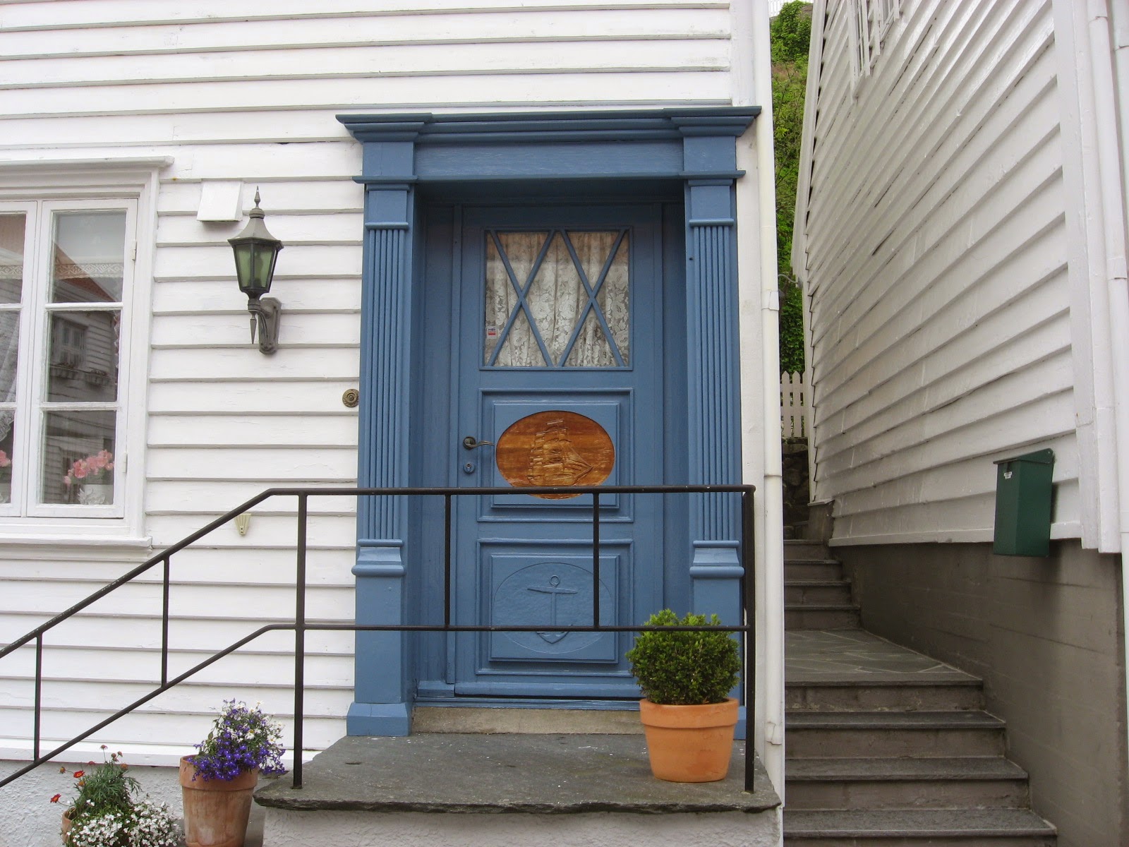
We made landfall in Skudeneshavn on Friday, July 15. It was a beautiful, warm, sunny summer’s day and our first real taste of summer in 2011. Skudeneshavn was as beautiful as I had read. The old section of town is a typical ‘white village’ found all along the south coast of Norway consisting of tiny, narrow streets of old wooden houses, all the houses are painted white and in Skudeneshavn have the same red clay tile roofs (in other places, like Bygdoy in Oslo, the houses are all white, but, have black tile roofs). There must be strict planning guidelines to get everybody to maintain the same colour scheme. The effect is totally charming.


Images of Skudeneshavn, Norway.
After leaving Skudeneshavn, we spent a few days cruising the local area around Stavanger/Tananger. We travelled up the beautiful Lysfjord, which has the famous ‘Pulpit Rock’ and many lovely waterfalls. One night was spent near Utstein Kloster, an  old monastery we walked to one evening.
Utstein Kloster
Lysfjord

Lysfjord
A lot of Norwegian homes have sod roofs, these examples blend in beautifully with the surrounding landscape.
After leaving the Stavanger/Tananger area, we headed south to round the southernmost point of Norway, Lindesnes. We planned to follow the coast to Sandefjord and from there take a bus to Oslo. This would save us the long journey up the Oslofjord. We rounded Lista and Lindesnes with no problems. However, once on the other side, we found ourselves with a strong adverse current, wind and waves on the nose. We have discovered that our boat doesn’t sail to windward, at all, period. It took us ten hours to do seventeen miles, most of it with the motor on. There didn’t seem much point in continuing further along the coast with this slow progress. Only the Oslo visit was left for us to see in Norway anyway. So, we stopped at Mandal, another lovely ‘white town’ and from there it was two buses and about six hours to Oslo. We had a whirlwind two-day visit and Oslo did not disappoint, it was wonderful. We spent one night in a hotel (what a treat!) which included an Oslo Pass and we took full advantage of it to visit fascinating museums and travel the length and breadth of the city.

Oslo still seemed stunned by the events of less than a week before. Our hotel was just a couple of minutes from the site of the explosion and the devastation was just left as-is, no attempts at a cleanup had yet been started. Of course, it was all cordoned off and there was a police guard. The damage was widespread and even buildings far away from the site sustained significant damage. There were impromptu floral tributes and shrines all over town and people were still laying flowers.

With only two days, it was a bit of a rush, but, we crammed in everything we wanted to see. This included visits to the following museums:

1) the Viking Ship museum, a stunning display of three Viking ships that had been used as burial chambers. One contained two females and this was the most elaborately outfitted containing a complete carriage and four sleds. These were carved in the most intricate designs and embellished with silver and bronze nails. The amount of well-preserved artefacts was amazing and fascinating to view.

One of the four sleds buried with the ship.
2) the Fram museum – The ‘Fram’ was the boat built by Nansen and used in many polar expeditions. It was used by Amundsen on his successful voyage to be the first person to reach the South Pole. Having just been to Svalbard and Skjervoy, where the ‘Fram’ made landfall after its first northern polar explorations, it was interesting to look at all the maps of the polar regions and see where we had been in relation to where they went. I had also just finished reading Shackleton’s account of his Antarctic polar voyage of 1914-1917, so it was all timely information and most interesting. You can actually get onto and right inside the ship. One observation was how much Norway had to do with early explorations in the Canadian Arctic. Amundsen was the first person to sail through the North West Passage and the ship used to do that, ‘Gjoa’, is also onsite at the Fram museum. Norway also did much of the early surveying of Ellesmere Island and environs, which became Canadian territory only in 1925.
the Fram, inside its own museum building
3) the Kon-Tiki museum – didn’t know much about Thor Heyerdahl and his voyages before visiting this museum other than the famous ‘Kon-Tiki’ name. The museum displays the balsa raft he used in his first major voyage across the pacific and also ‘Ra’ the reed boat he used in a later voyage.

4) Norwegian Resistance museum – bit disappointed with this display, there was only a little mention of the ‘Shetland Bus’ that I have previously discussed. However, it did manage to fill in a few blanks about events during the war.

5) Vigeland Sculpture park – I guess everybody who goes to Oslo comes here, they get about a million visitors a year and there were loads of tour buses having a look. It’s the life work one man, consisting of about two hundred bronze, granite and cast iron sculptures.
Vigeland sculpture

Vigeland sculpture
The Oslo visit was a fitting farewell to Norway as we will be leaving here tomorrow, headed for Goteborg, Sweden. After eleven months cruising almost the entire coastline and experiencing both the polar night and midnight sun, it’s time to leave. It will be a short (hopefully) 140 mile voyage across the northern tip of Denmark and down Sweden’s west coast to Goteborg, where we will travel through the Swedish internal canal system to Stockholm. We are leaving from Mandal, the most southerly town in Norway. The town is very yacht-friendly, the gjestehavn (guest harbour) is run by the town and every morning they leave freshly-baked rolls with butter and jam and a newspaper on your boat! Makes us feel like staying in Norway. It’s been a wonderful visit, but, we are eager for new horizons now and ready to move on.
Sand sculpture


 photo arrow.pngCONTINUE READING

Thursday, 30 June 2011

Most sailors in the northern latitudes are out sailing by the beginning of June. We were still in Tromsø studying ice reports and contemplating our planned voyage north to the Svalbard archipelago, about 600 miles north from the Norwegian mainland. To make it worse, there had been one or two really lovely spring days in town and we were getting antsy to leave. Svalbard weather reports didn’t look that promising, some of the fjords were still blocked with ice and the temperature was hovering around 0-2C with snow showers. After a long, dark winter we were relishing some summer weather, not more winter. We started to second-guess our decision to head north. After all, when we’d arrived in Tromsø last fall, we hadn’t intended to travel any further north. We’d heard about Svalbard, but, thought it would be far beyond the capabilities of both us and our fibreglass boat. In addition, there seemed to be a high degree of regulation and bureaucracy involved as well.

This is an ice report from May 23. Most of the fjords are ‘fast ice’ with ‘drift ice’ all along the western coastline. Note the ‘?’ just north of the island at the bottom, this really instilled a lot of confidence!
After doing some more study and talking to others about it, it seemed that it would be ok to go in a fibreglass boat, as long as we stayed on the west coast of Spitsbergen, the main island, paid attention to the ice charts and didn’t put ourselves in any places where there was a good likelihood of being trapped by ice. The other caveat was to keep a good watch to avoid hitting any floating ice which would be quite likely to punch a good-sized hole in our hull. After reflecting on our crossing of the North Atlantic and North Sea last year, we thought sea conditions and the actual sailing couldn’t be much worse than we’d already experienced, so, we decided to head north. However, this decision came with a string attached, we promised ourselves we could go as long as it didn’t impede our decision to be somewhere warmer for next winter. This put a time constraint on our visit as we wanted to be entering Sweden and the Baltic around the beginning of August. To get north and back again required leaving Tromsø around mid-June.

The days dragged along and a week of grey skies came back to Tromsø adding to our dismal mood. Should we go, or, shouldn’t we, it was constantly on our minds. Finally, a weather window opened up, a whole week of sunshine and fair winds was forecast and we were off. A busy final few days ensued, closing up our affairs, doing last-minute provisioning and saying sad farewells to the good friends we had met over the winter. I had heard that constantly having to say goodbye is one of the hardest parts of cruising and that has proven to be the case for us as well. We departed on Thursday, June 9, to do a three day mini shakedown cruise prior to leaving the security of the mainland for the voyage north.

Leaving Tromsø gave us a fine view of the oil rig that had been towed in for repairs.
The warm, sunny weather arrived on schedule and we had a delightful three days cruising east to Skjervøy, the small town where Nansen’s ship Fram returned in 1896 after her polar circuit. The town has a stunning setting with a well-sheltered natural harbour surrounded by tall, snow-covered peaks. We thoroughly enjoyed sitting outside in the sunny cockpit for the first time this year, watching the fishing boats come and go. G casually waved at a fisherman in a nice-looking boat. Later, the fisherman came over to chat and brought us a gift of about two kilos of freshly caught shrimp! Fresh shrimp (‘ferske reker’) are sold off the back of fishing boats all over Norway and are usually consumed with a mayonnaise-like dressing for dipping. To be honest, I’m sounding ungrateful, but, as much as we appreciated the gift, we didn’t appreciate all the head, leg and tail peeling prior to eating. Also, the shrimp are cooked on the boat already and we found them way too salty, they must have been cooked in salt water. Anyway, it was a lovely gesture and much-appreciated, in spite of our squeamishness.

After visiting Skjervøy, we made a short side-trip to the Jokelfjord glacier, the only remaining glacier in mainland Europe to calve into the sea. We experienced our first taste of sailing with ice in the water here, it was exciting at the time but proved rather tame with what was to come later.

Jokelfjord glacier
We made our final preparations for sea and left the mainland on Sunday, June 12 to head north out into the Norwegian Sea. Almost immediately, all the bad memories of our North Atlantic crossing came back with a vengeance. First, our choice of exit point could have been better. We exited through an area of the coastline known to have potential for severe wind over current turbulence. The last remaining vestiges of the North American Gulf Stream run along the north coast of Norway, known as the Norwegian Current in this location. There had been a near gale the night before and although the wind was now only about twenty knots, the sea was still very confused. We were getting thrown around in what can only be described as what it must feel like to be in a washing machine. We know it’s bad when the crockery starts breaking and we lost a souvenir coffee mug we’d only just purchased. We tried sailing until the wind eventually died, we tried motoring, that was worse. In the end, we basically just hung on as we pounded into the head seas. Then, things started to fail. We went to put the Monitor windvane air paddle on and the handle broke off and fell into the sea. The Windex monitor at the top of the mast broke in half and fell off. G noticed the new bilge pump seemed to be on all the time. He didn’t want it to burn out, so, he turned it off. Within ten minutes the bilge was full and there was water over the cabin sole (and over our newly installed propane gas monitor sensor). We madly started hand-bailing into the galley sinks and pumping it overboard from there. Once we’d cleared the water, it didn’t come back. We can’t figure this out. We thought originally it was being caused by excessive wave action over the bow and maybe coming in through the hawse pipes and/or chain locker somehow, but, there is just nowhere for it to get in. A clue from this recurrence was that it seems to stop when we slow the boat down and lessen the amount of heel. So, now we think it might be some kind of back-siphon via a through-hull, but, we’re not sure where or how. This is a mystery that may never get solved. At least having experienced it once before, this time didn’t induce quite the same level of panic as the first time!

Next was the near collision with a freighter. At ten minutes to CPA (closest point of approach), I called the other boat to find out their intentions for passing. The first words I spoke on the VHF blew a fuse and the radio went dead! After a mad scrabble through the ditch bag, I pulled out the handheld VHF and made contact to ask whether he was planning to pass us ahead or astern. He said ‘ahead’ and then added ‘I think’, very confidence-inspiring. It was ahead, but, so close we could almost see the whites of his eyes on the bridge. We have never passed so close to a boat before. Normally, we try and stay out of their way and would have taken evading action much earlier, but, in the severe waves we were in, we were afraid of a broach, or, a knockdown and as we were the stand-on boat, thought it better to maintain our course and speed and let him make the minor adjustment required to pass astern of us. At this point, we had one of those moments where you question ‘why am I doing this’ and almost turned back.

By the next day, the waves had reduced in size by ½ and were generally now all coming from the same direction. We were far enough offshore to be away from the confused seas and all the local shipping. What a relief. It was grey, cloudy and cool, but, we had winds from just the right direction and we sailed for almost three days, on the rhumb line, between 5-6 knots without having to touch the sails, or, the windvane, the entire time. We made the best day’s mileage ever and it was great. More of the same please! The skies cleared off just enough for us to spot Bjørnøya (Bear Island) on the way. This is a bird sanctuary island located conveniently ½ way to Spitsbergen. We had originally planned to stop here, but, due to the uncertainty surrounding the location of the pack ice to the east, we thought it was better to stay well west and we passed it about thirty-five miles off. We were unable to see Sørkapp (South Cape) on Spitsbergen due to poor visibility. When land finally hove into view, it was a most peculiar sight with a low, horizontal band of cloud cutting off the tops of the mountains from the mid-way point, but, with the light underneath the clouds somehow still glowing and reflecting off the bands of snow cover.

first view of Spitsbergen

At this point, our favourable wind started to fail and we were into the ‘normal’ wind pattern for Svalbard at this time of year, light and variable. We fiddled about with the sails a bit, then, decided to start the motor and get into Longyearbyen, the main town and administrative centre for Svalbard.

Svalbard is located at the junction of three seas: the Greenland Sea, Norwegian Sea and Barents Sea. It is an island archipelago and is the nearest it is possible to sail to the North Pole, just 600M further north from its north coast. 60% of it is glacier and only 6-7% can support any plant life due to permafrost. In 1920, sovereignty over Svalbard was granted to Norway and Norwegian law is followed. However, Svalbard has its own Governor (Sysselman) and is a duty-free area. The year-round population is approximately 3,000 with about ½ being Norwegian, the other ½ are Russian/Ukrainian. Russia still has mining interests and the town (one of only three) of Barentsburg is almost totally Russian in population.

The town of Longyearbyen, the main settlement, is quite industrial-looking and has the character of a frontier town. All the buildings are on stilts, due to the permafrost. The people are a varied mix: tourists, scientists, students, mine workers and a few frontiersman, who were easily identifiable with their weatherbeaten faces and heavy outdoor clothing. A number of people were walking around with rifles over their shoulders. It’s not required in Longyearbyen, but, everywhere else it is a requirement to carry a rifle, due to the polar bear risk. This includes yachtsmen and we thought we’d have to rent a rifle for our visit. We were reluctant to do this and as we were only staying a week, the easiest solution was to just not go ashore and hope that bears don’t climb onto sailboats.

As it was, we didn’t see any polar bears although many other boats did see a number of mothers and cubs. Those boats, though, were either larger and/or made of steel/aluminium and therefore able to go to areas where there was still ice where most of the bears live. A couple of other boats had close encounters with whales. We saw quite a few spouting off in the distance, but, didn’t have any close encounters, maybe a good thing. It was still a thrill to hear them breathing and sense their massive presence nearby.

photo courtesy of Rudi Caeyers . We didn’t see any bears, but, G’s friend Rudi shot this photo just a couple of weeks ago. For more of his great photos, see www.rudicaeyers.com

The wildlife highlight for us was seeing walrus in their natural habitat. The walrus colony at Poolepynten can easily be seen from a boat. We approached the shore carefully and there they were. Huge mountains of flesh piled up together in a large, brown heap. Many were on their backs with their tusks in the air. We got close enough to smell them, very fishy and they barely seemed aware of our presence. A couple of them were in the water feeding. We watched one giant lumber down to the beachfront via his jiggling flesh, what an effort. Once in the water though, he was very graceful despite his size and shape.

the walrus colony at Poolepynten

the walrus colony at Poolepynten
On arrival in Longyearbyen, the weather had been grey and cool. As we started our week’s cruise north to Magdalenfjord, the weather changed to an unbelievable stretch of sunny, warm, cloudless weather. The air temperature was only 4-7C, but, the warm sun made up for it. We were able to just wear light jackets and forego the long underwear for a while. All our worries about having no heat on the boat while sailing, or, at anchor went away. We have a heater while motoring and as the high pressure that brought sunny skies also brought a lack of wind, we motored a lot and were quite toasty.

Cruising to Magdalenfjord took us as far north as latitude 79 degrees and 34 minutes. It was hard to imagine we were just 626 miles from the North Pole at this point. We were also less than fifty miles from the permanent ice cap where the sailing stops rather abruptly. The last sunny day, of our run of five, was when we sailed into Magdalenfjord. It was about 11 p.m. and we were just heading into the anchorage. The sea was absolutely flat with that oily motion it gets in a calm. The sun was still high in the sky. There was a very light mist in the air reflecting a brilliant white light from the sun. The sea was like molten gold on which we were floating with a gentle motion. I now know where the term ‘white night’ comes from and it is an image not soon forgotten.

Here’s proof, just 626 miles from the North Pole!
In the morning we had a surprise to see that another boat had come into the anchorage during the night. It was more of a surprise that we knew the boat and its captain. It was ‘Ulla Rinman’ from Tromsø, a converted lifeboat that now takes charter guests on Arctic adventures. G had met Geir, the captain, in Tromsø over the winter and had helped him move the boat across town. We chatted with him on VHF prior to departure.
‘Ulla Rinman’ at Magdalenfjord
The scenery throughout the cruise was spectacular. The Arctic mountain landscape doesn’t have the verdant green forests and turquoise-tinged glacial lakes of mountain ranges to the south. However, it is still beautiful in its own way. The basic elements are water, rock, ice, snow and sky and the beauty comes with the interplay of light and shade on the various surfaces. The terrain is almost totally vertical. Each valley seemed to have a glacier in it, many calving directly into the sea.

Our first anchorage at Trygghamna, near Longyearbyen
 An exception to the rule of a barren landscape were these beautiful Arctic flowers seen an Ny Ålesund.
Sea cave near Blomstrandhamna, we saw people go right into this cave in a dinghy.
 It was easy to get blasé about glaciers because there were so many, but, they were fascinating. At a number of anchorages, we were able to get quite close. Our favourite was at Dahlbebrukta. This anchorage looked marginal on the chart and we were nervous going in as there was quite a bit of large ice in the water. It was late, around 1:30 a.m. and we just wanted to get stopped, anchored and into our bunks. As we expected, there were a few bumps on the hull in the night from ice hitting us. We awoke to what sounded like pouring rain, but, the brilliant sunshine coming through the portlights showed that was impossible. What on earth could it be? Emerging into the cockpit we soon saw that a large berg must have calved in the night and the bay was now filled with splinters of it all around us. I’d heard that glacial ice makes a popping noise in the water, but, this was incredible. It sounded like the sea was alive with the snap, crackle and pop of the air coming out of the ice. It was very weird and exciting at the same time. There was a lot of glacial ‘blue ice’ (the very dense older ice) in the water as well, very scenic.

Dahlbrebukta glacier. This photo was taken at midnight!

One of the beautiful bergs at Dahlbrebukta

Waggonbreem glacier at Magdalenfjord
Another interesting stop was to the smallest of the three settlements on Spitsbergen, Ny Ålesund. It’s a research station with about 25 year-round residents. In the summer, about 200 scientists and students come to do research from all over the world. China, Korea, France, Germany, India and of course, Norway, all have research stations here. The Poles also have a large presence on Spitsbergen, but, their research station is based in the south of the island. Ny Ålesund is the place where Amundsen launched his airship, ‘Norge’, on its historic crossing of the Arctic in the 1920’s. The tower used to tether Norge still stands.
World’s most northerly post office at Ny Ålesund.
mini-train used at Ny Ålesund for coal transport
After completing our cruise, we are now back in Longyearbyen for a couple of days. We are getting caught up with showers, laundry, diesel, water etc. and will be provisioning for our voyage south. We expect to leave by July 1, be at sea for about three weeks, travel about 1200 miles and hope to make landfall in South Norway, somewhere south of Bergen.
Black Sheep II at the dock in Ny Ålesund

CRUISING NOTES
For the sailors reading this, our trip to Svalbard was a great success and highly recommended, if travel in the northern latitudes appeals to you. Any well-found boat with an experienced crew should be able to make the trip to the west coast of Spitsbergen, with the right weather and ice conditions. High pressure, when it arrives, tends to remain stationary and the weather settled, more so than in latitudes further south. The winds tend to be light and variable, so, expect to motor and purchase a lot of diesel. Northbound progress up Spitsbergen may be slow as the prevailing winds are usually from the north.

Navigation aids are few and far between. The only real navigational challenge is the ice potential and one tricky bit of navigation in the strait between Spitsbergen and Prins Karls Forland (island), Forlandsrevet, where there is a 0.5m narrows with 3meter depth. We never did identify the transit for getting through here (lining up a point with a rock buttress) as there was cloud hanging over the mountain tops both when we were northbound and southbound. Our CMAP electronic charts seemed to be accurate and our chartplotter got us through easily with no problems.

A permit is required from the Governor’s office to visit Svalbard, SAR insurance is required, landing fees must be paid and a rifle rented, if you are going ashore. Although it sounds onerous, the whole process was basically effortless, just filling out the application form with proof of insurance and sending it in. Our insurance broker was able to provide the SAR insurance for only an additional $100 on our premium. When we were out cruising, we twice met RIBs with Sysselman officials aboard and they knew our names and that we were on the approved ‘list’, so, make sure your paperwork is in order before arriving.

Postscript: We had an email from Mark and Jane, who stayed in Svalbard for a few weeks after we left at the end of June. Apparently, there was an ‘ice event’ in July where ice was swept into Longyearbyen harbour and filled it overnight. Even cruise ships were unable to enter the harbour. The dock we were tied up to, along with the boats attached to it, was broken away and pushed down the shoreline with damage to the boats. I’m really glad we missed that!

 photo arrow.pngCONTINUE READING